Opening Ceremony of the Exhibition and Seminar: Heritage Documentation
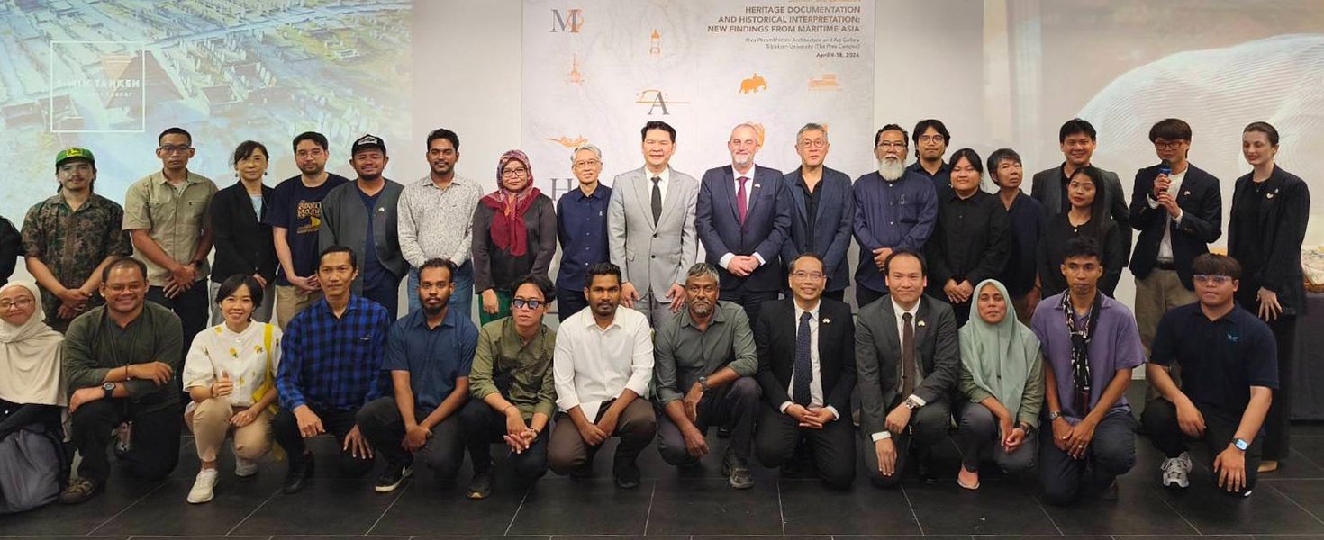
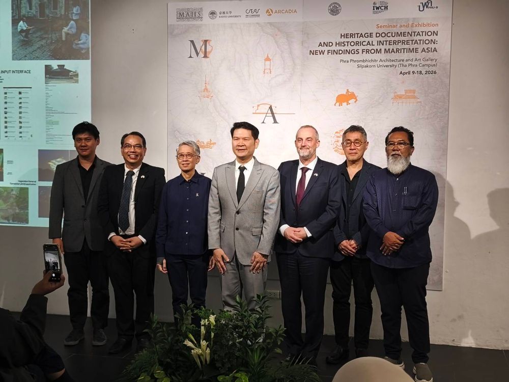
On April 10, the opening ceremony was held for the exhibition and seminar titled "Heritage Documentation and Historical Interpretation: New Findings from Maritime Asia." Hosted at the Faculty of Architecture, Silpakorn University, the event marks an international collaboration with Kyoto University.
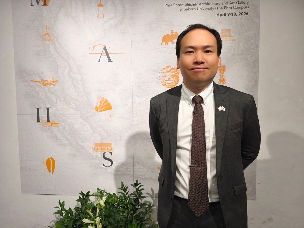
Assoc. Prof. Dr. Kreangkrai Kirdsiri, Associate Dean for Planning, Research, Special Affairs, and Quality Assurance at the Faculty of Architecture, Silpakorn University—the project lead—explained the project's origins. It was established by Professor Dr. R. Michael Feener, Director of the Maritime Asia Heritage Survey (MAHS) at the Center for Southeast Asian Studies (CSEAS), Kyoto University, who is a world-renowned expert on the Islamic world.
“Professor Feener is originally from Massachusetts and spent much of his childhood outdoors. His interest in this field stems from Massachusetts' historical connection to maritime heritage and the Muslim world. In the past, ice was harvested from his hometown and shipped for sale in India and Singapore—and quite possibly even to Thailand during that era. This sparked his curiosity to delve deeper into these subjects. He later studied language and law, eventually studying in Yemen, which led him to become a prominent expert in epigraphy and a leading scholar of Islamic Studies in Southeast Asia. Recognized as one of the world’s foremost Islamic scholars, he is fluent in Arabic, Farsi, and Japanese.
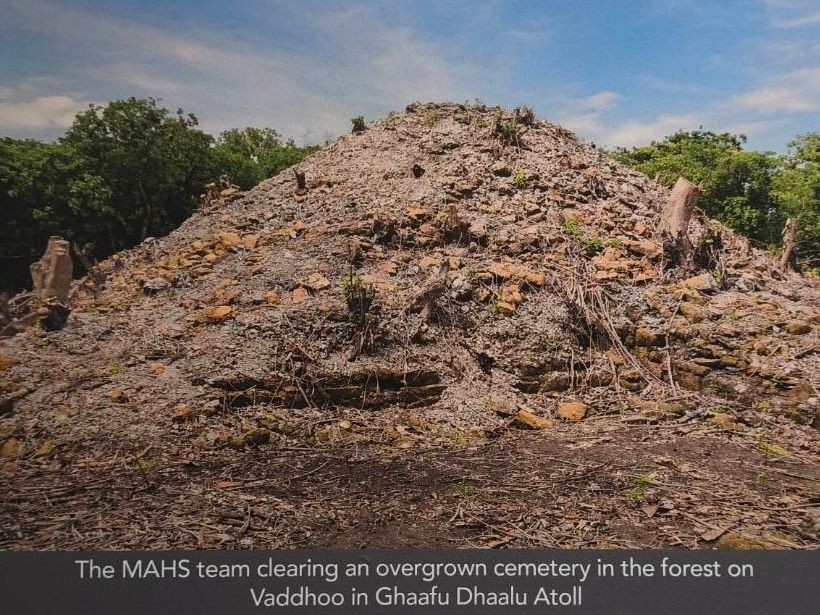
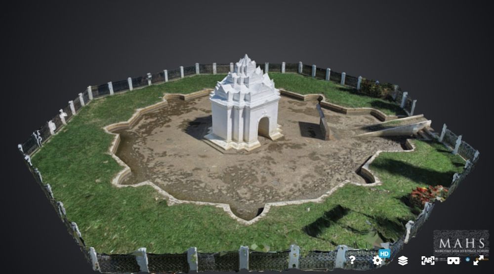
After securing funding to study maritime history and culture, Professor Feener chose the Maldives as the first site for the project. The Maldives is already a focus of global concern due to its geography as a series of ring-shaped coral atolls, with the entire nation sitting only 50–100 centimeters above sea level. Consequently, if sea levels continue to rise, the Maldives would be the first country in the world to submerge. Research indicates that the Maldives was part of the Maritime Trade Route, with significant inscriptions recording the spread of Islam, leading to its status as a Muslim nation today. Looking deeper into its past, the project discovered ancient stupas built from coral stone, dating to the same period as Anuradhapura in Sri Lanka, showcasing immense cultural diversity.
The Maldives was prioritized because of the imminent risk that rising sea levels would cause this cultural heritage to disappear forever.
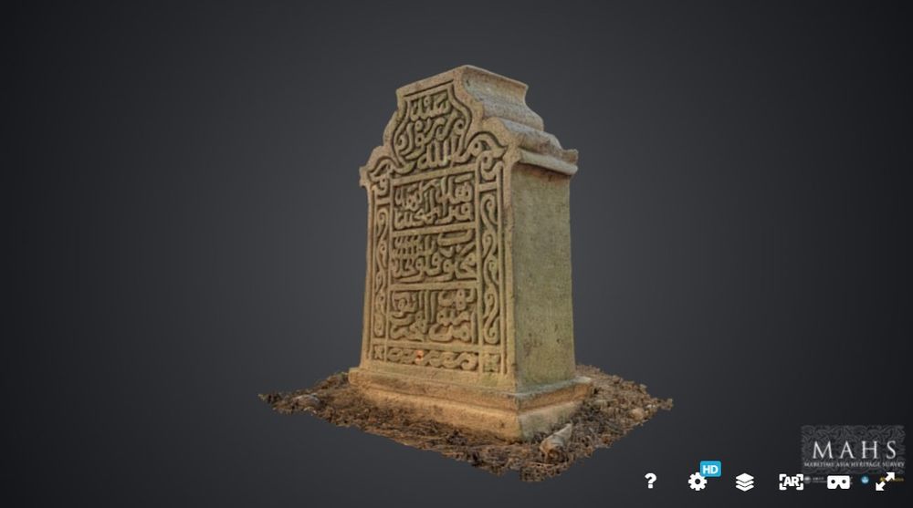
The next area Professor Feener chose to study was Aceh, Indonesia, as it was the first point of entry for Islam into Southeast Asia. Additionally, Aceh was devastated by the tsunami, making it an urgent site for study because much of its historical and cultural evidence had already been destroyed.
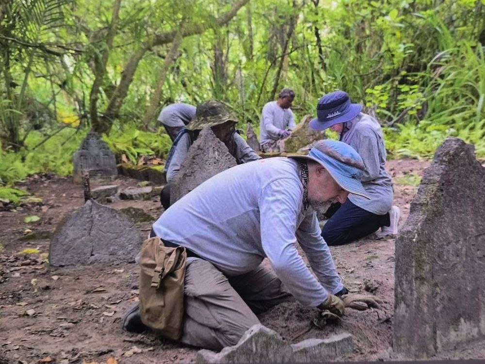
In Aceh, we focused our study on tombstones because they contain inscriptions, records, scripts, languages, and dates that allow us to study the history behind these messages.”
Thailand was originally outside the scope of this project, as Vietnam was planned as the next site, focusing on the continental shelf routes connected to the major seas. Since Thailand’s coastline is recessed, it wasn't in the initial plan. However, Thailand was included through the efforts of Assoc. Prof. Dr. Kreangkrai Kirdsiri, who recognized the project's significance and emailed Prof. Dr. R. Michael Feener to invite him to Thailand.
He provided information regarding Thailand’s readiness for coastal studies, noting that Silpakorn University was already conducting similar research, possessed some equipment, and had a workforce with local expertise in the Southern Border Provinces and other regions. Another factor that piqued Professor Feener’s interest was that, despite his extensive writings on Islam in Southeast Asia, none of them had yet covered Pattani—a region which, like Aceh, served as an early entry point for Islam.
When asked about the benefits Thailand and Silpakorn University gain from collaborating on such a large-scale project, Dr. Kreangkrai stated, “First, it makes Thailand known to the world, and our university gains international recognition. In terms of knowledge, it allows us to stand alongside leading academic institutions. The entire field team consists of our Master’s and Doctoral students, all of whom received a regular monthly salary from Kyoto University for two years. Beyond education, we are developing academic personnel. Ultimately, the true benefit belongs to the world, not just Thailand, because the research findings are published online as Open Access, free of charge.”
At the same event, Kullaput Seniwong Na Ayudhya, the field survey team leader for the Thai team, gave an interview regarding the project's importance. It began with the goal of documenting cultural heritage sites facing threats, starting in the Maldives, moving to Indonesia, and then Thailand.
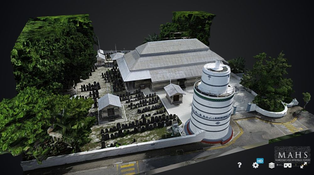
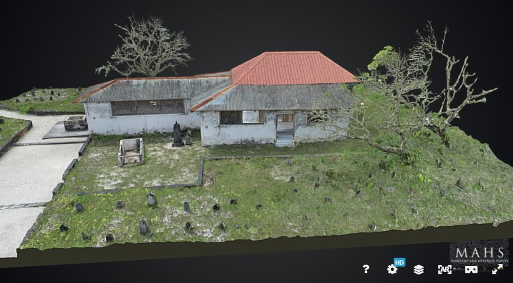
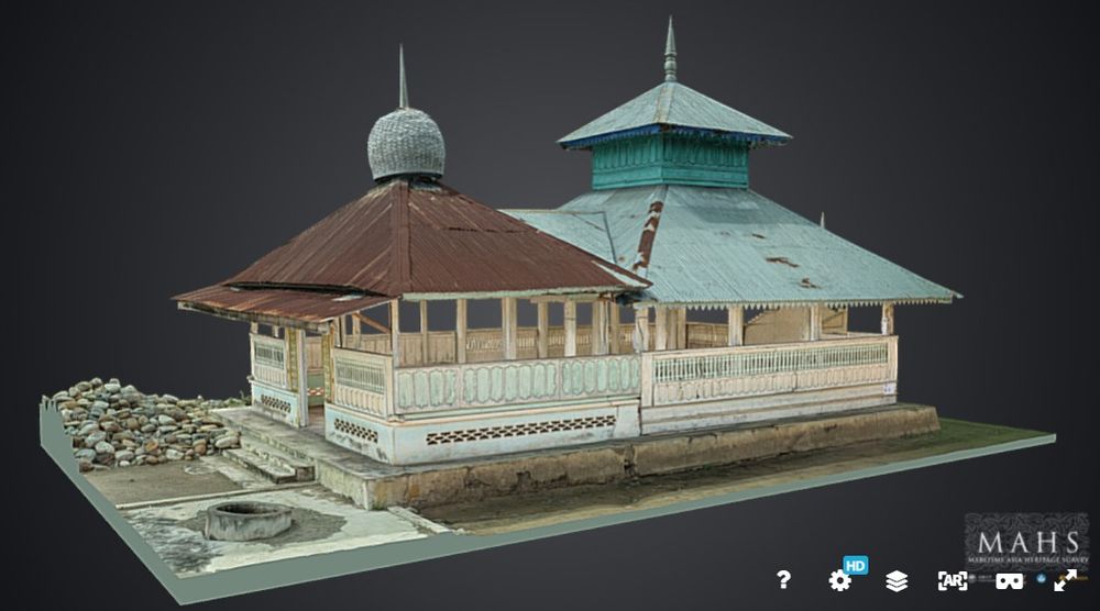
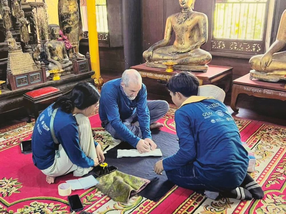
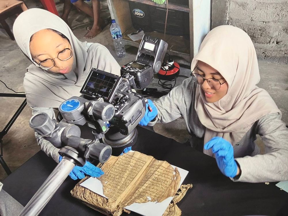
“We document cultural heritage at risk of decay, such as in the Maldives, which is affected by climate change and rising sea levels. In the future, these sites risk disappearing. We use digitalization, photography, and state-of-the-art methods like LiDAR Drones (Light Detection and Ranging). These drones use laser sensors to measure distances and create highly accurate 3D models (Point Clouds) with centimeter-level precision. This is ideal for land surveys, topographic mapping, forestry, infrastructure, and inspecting high-risk areas. We also use Photogrammetry—the science and technology of creating accurate 3D models or maps. All the data collected is uploaded to our website as Open Access, accessible globally. Users only need to credit the project. The website can be visited at https://maritimeasiaheritage.cseas.kyoto-u.ac.jp/
For Thailand, we worked in the coastal areas of the South and Central regions, focusing on maritime connectivity. The collected data is sent to Kyoto University, which has supercomputers to process all the imagery. The data is then backed up in three countries: Oxford, England; Kyoto, Japan; and the country of origin. For Thailand, the data is stored at Silpakorn University. This decentralized storage is designed to ensure that if a disaster or war occurs, this information will survive.
The data collection is diverse, including photographs, 3D images, and filmed documentaries to capture Intangible Cultural Heritage. However, this intangible heritage must be linked to artifacts. For example, regarding Muslim headwear that is difficult to explain through text alone, we produced a documentary to accompany the artifact. You can view our documentaries on the YouTube channel: Maritime Asia Heritage Survey.”
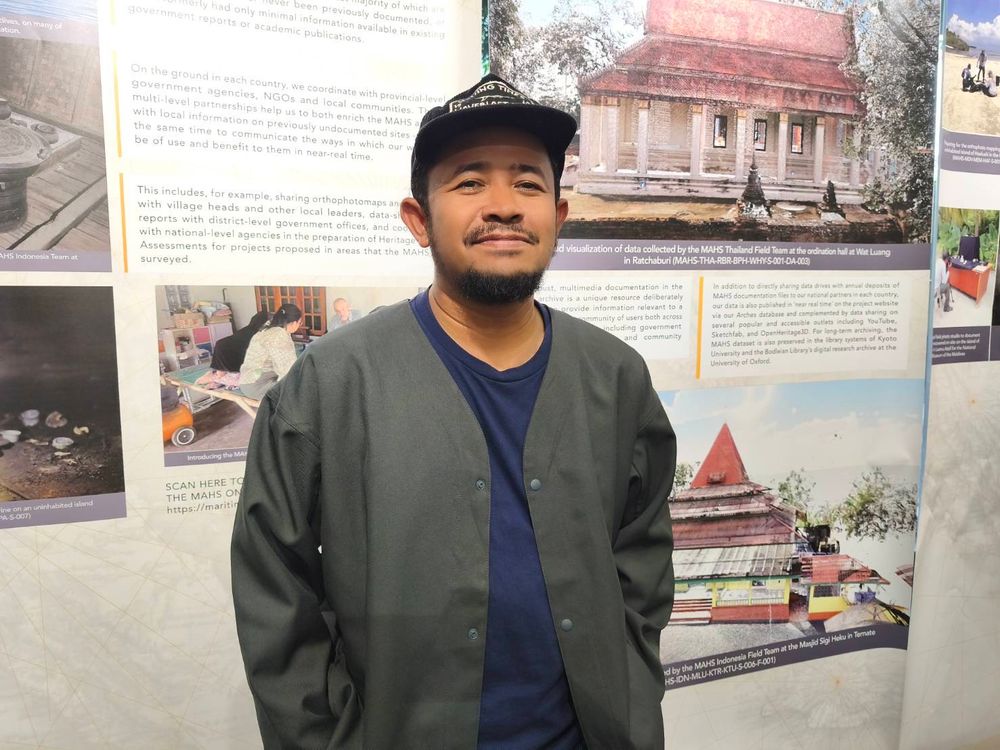
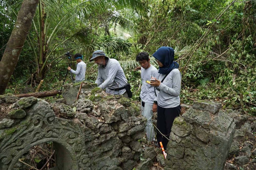
Meanwhile, Anas Pongprasert from 'The Looker' group in Pattani, who served as the primary coordinator for the three Southern Border Provinces, helped select archaeological sites and cultural data that aligned with the project's goals. Collecting data in a conflict zone is not easy and required local presence and strong relationships to facilitate the main team’s work.
“We collaborated with the research team to design which issues were of interest across Narathiwat, Yala, and Pattani. We selected everything from kubur (ancient cemeteries) to historical buildings and architecture. Due to the project's limited timeframe, we couldn't document everything, as a project of this nature had never occurred in the three border provinces before. We estimate there is still much more data to be gathered. This project serves as an excellent 'catalyst' for further research or cultural movements. Since it is Open Source, I believe that as someone who has always worked in cultural advocacy, this data can be utilized extensively in the future.”
When asked how he personally—as part of a group driving culture in the Southern Border Provinces—could tangibly use this open data, Anas Pongprasert said, “In the three provinces, there is a clash of identities between the state’s perspective and the people’s perspective. I believe this scientific data will be a great starting point for finding a conclusion in defining that identity because the data is verifiable. Some stories are based on oral history; once a research team documents them, they gain more weight and can be referenced. This can help reduce conflicts arising from differing views between Thai state history and local history that have yet to find common ground.”
© 2025 Khaoyai Connect. All rights reserved.
No part of this content may be copied, modified, or distributed in any form without prior written permission.
